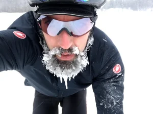
This is a quick and punchy post to share what Todd, Iain, and I learned about new-to-us roads circumnavigating Parc Mont Tremblant, with an eye to establishing a fixed bikepacking route.
Having spent time in the Parc prior, mostly connecting across from Ottawa, it was a surprise to learn that Rouge Matawin Wildlife Reserve butts up against the northern boundary of the Parc, and also offers managed camp site options.
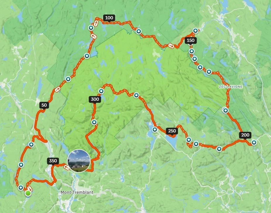
The plan.
The unpaved roads connecting from our remote start eastward along the edge of the Reserve were a complete question mark, so we chose to ride the widest tires we could fit to our bikes. Given we’re all still on what I will heretofore refer to as ‘legacy gravel bikes’ - those fitting 700c x 45mm or smaller tires - we took the strategic decision to all run our 650b wheels, which were set up with a range of tires from 40mm to 50mm. While less efficient than larger diameter wheels, volume is the priority when loaded and tackling questionable roads that might become trails.
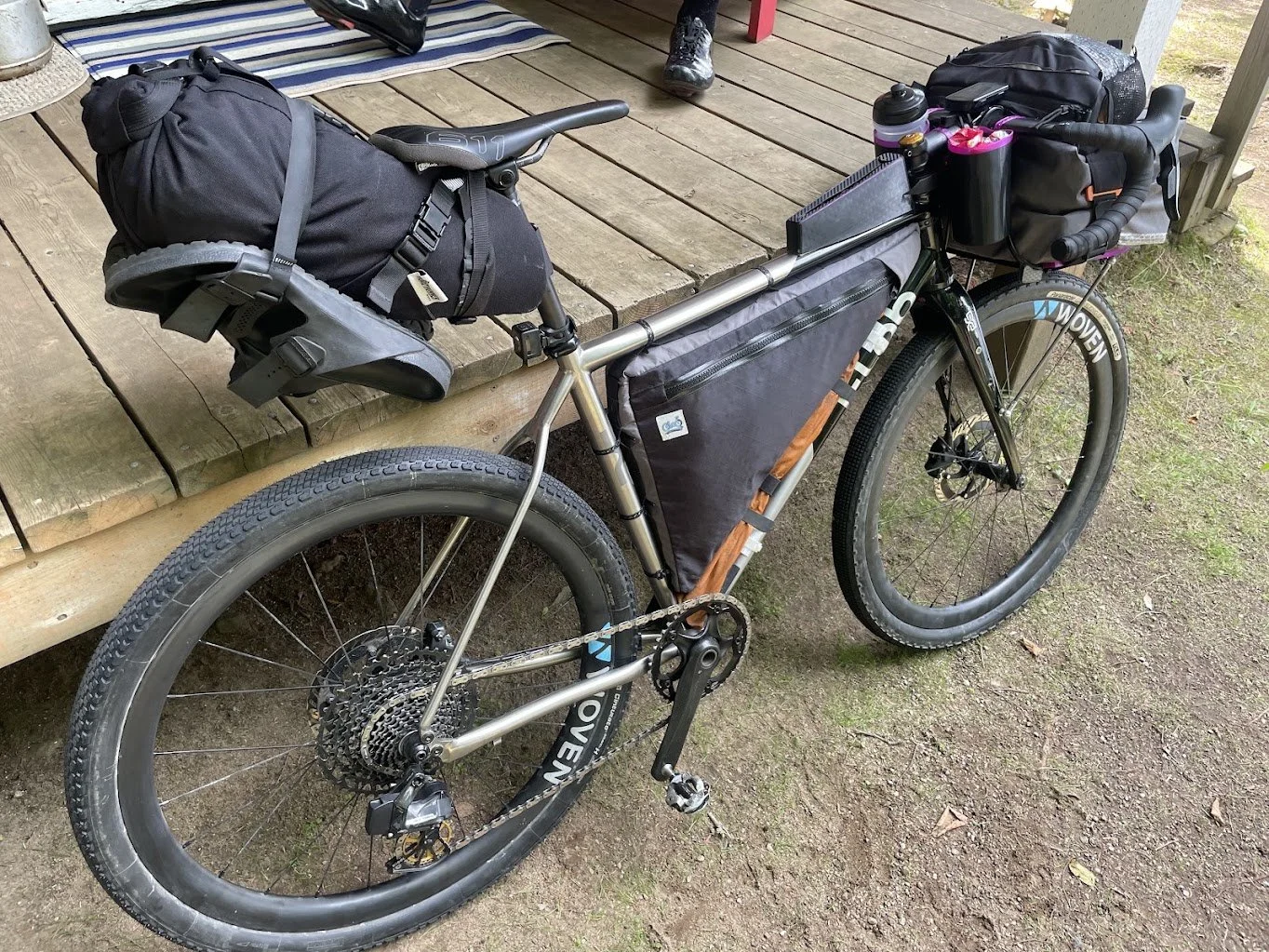
I ran a Pirelli Cinturato Gravel H in 650B x 50mm, which had a casing wobble defect straight out of the box. Frame clearance looked acceptable unloaded, but under full bikepacking weight, the tire rubbed the chainstay slightly. Active tire rub is a hard red line on carbon due to structural abrasion, and while titanium is far more resilient, continuous gritty friction will eventually score metal tubing too. I monitored it closely over the three days, ready to dish the wheel over via spoke tension if wear progressed, before returning it to MEC for warranty post-trip, notably the first defect I’ve encountered across seven Pirelli tires. Up front, I ran a Panaracer GravelKing SK in 48mm, which performs solidly but throws a notorious amount of grit. Loaded bikepacking rewards heavy, damped tire casings that might feel sluggish unloaded; running ultra-fast, thin XC rubber like a Schwalbe Thunder Burt or Continental Dubnital here would be wasted unless you’re racing and willing to trade casing protection for speed.
Day-1
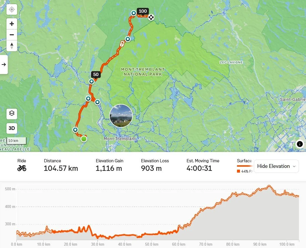
Day-1: Lac Cameron to Opinel Campsite
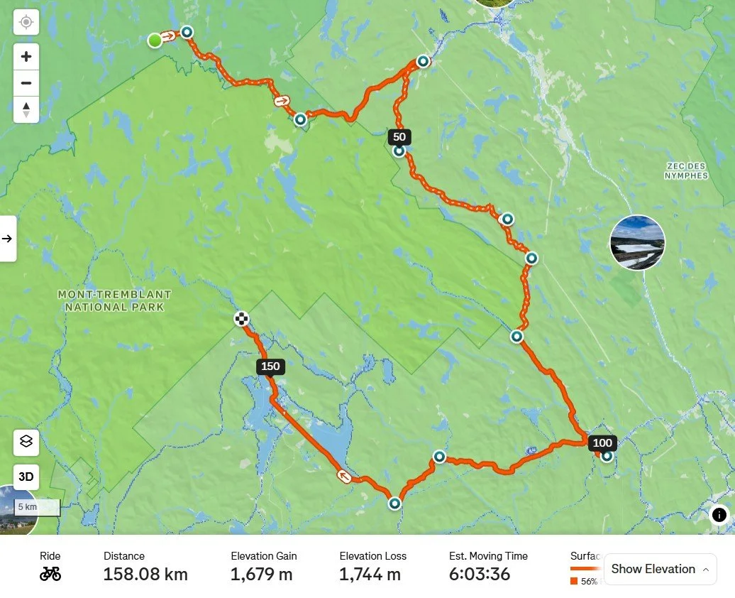
The main question most will have for this leg pertains to the road condition from around Km 60 - 105. Sandy-gravel is how I’d describe it, rough and loose enough for tires smaller than 40mm to be a liability. We saw a range of cars and campers on the road, which appears to be consistently well-maintained; overall traffic level was low.
Learning: Rouge Matawin Reserve road are suitable for bikepacking.
Camp sites of the ‘rustic’ variety are bookable here: Sépaq Online Booking Portal. Judging by how readily I was able to book an available spot 4 days before we arrived, I suspect it will generally be possible to find an option on short notice, not least because there are numerous locations clustered around the 100km mark.
Learning: Rouge Matawin Reserve is a viable alternative to Parc Mont Tremblant for booking bikepacking-relevant campsites on short notice.
Amenities are the rustic camping area we stayed at includes picnic tables and fire-pits at the sites, and outhouses. C’est tout, c’est ca. There is no potable water supply, but the sites are all on lakes, so filtering access is easy. I intentionally went overboard and packed my three filter systems, which includes a 15yr+ old MSR MiniWorks, a Survivor filter, and a LifeStraw - the theory of redundancy theory.
Learning: Have and bring a water filter that allows you to filter water fast enough to meet your needs as an individual or group. The Survivor filter was woefully slow to operate, which could have knock-on effects. Bringing bleach tabs - as Todd did - is a great way to supplement filtering. They are miniscule, and offer peace of mind.
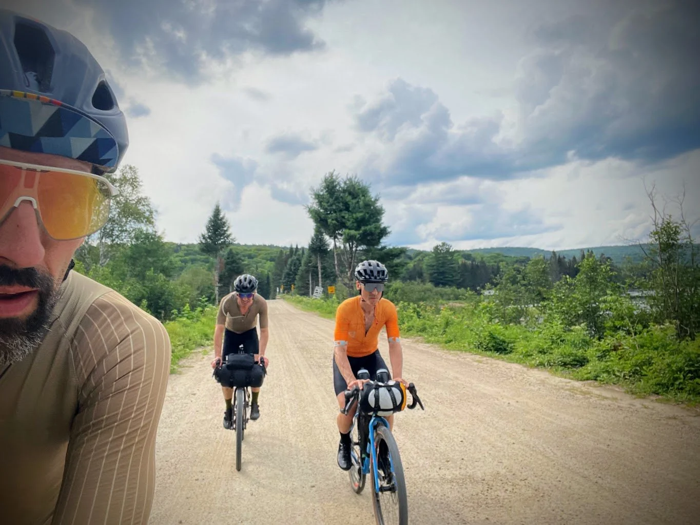
Todd and I opted to wear our Castelli Unlimited Pro 2 jerseys so we could carry reservoirs on our backs. Todd’s was a Hydrapak model in 2L, while mine was an insulated Hydrapak in 1.5L. Todd had two additional bottles, while I had one (on my handlebar), which allowed me to use my full-frame bag for gear, which I loved. Iain is carrying 2 950ml bottles in the CanCan holders I designed and made with my 3D printer (which I now have available for sale!).
Day-2
Day-2: Odelin to Pimbina
Riding out of the Reserve was straightforward, and road conditions were slightly rougher than the previous day’s leg. We arrived at an information centre at km-24, which has toilets, but no potable water. We transitioned to paved road for a while, then hooked around to begin the gravel road portion you can see above in ZEC des Nymphes.
ZEC stands for Zone d'exploitation contrôlée (Controlled Harvesting Zone). ZECs are non-profit-managed public lands set up by the Quebec government to manage wildlife conservation and offer public access for outdoor recreation, including hunting, fishing, camping, and bikepacking.
The ZEC unpaved sector we rode from km-45 through to about km-83 was rugged. It wasn’t until km-100 that we accessed water - this 100km took us 5 hours. I grossly miscalculated (read, ‘guessed’) we’d go 3 hours until accessing water, and only filtered 1.5L to cover that span. Oops.
Learning: Water filtration effort and speed influences decision making. It is probably wise to adopt a simple rule, and follow it: fill up all your water vessels when you have the chance unless you know for sure when your next access point is. At the system level, it is important to ensure your filter’s performance doesn’t influence how you decide how much water to process.
While we were fortunate not to be pursued and terrorized by horse and deer flies, the ZEC sector was rugged to the point of making little sense as a bikepacking route element. Popular with folks on side-by-sides, quads, and motos, the route we rode transitions from dirt road to more of a quad track, with a high degree of variability in surface condition; it will get very loose from extended periods of dry, hot weather. Fully-loaded, these conditions are rideable, and if that’s what you’re after - 'Can I ride it?’ - great. But the remoteness and lack of payback (like vistas and points of interest) make it a tough sell for re-use as part of another trip’s route. Meaning, mechanical failure will lead to a very challenging situation. Again, if wildness is what you’re after, fill your boots.
Learning: I’d recommend tires at or above 48mm, and built for durability over rock. Climbing grades warrant 1:1 and lower.
Learning: Cell coverage was ZERO for most of the 100km leg, so if you are travelling alone you should consider options for maintaining communications capability.
We homed in on a water fountain once in St Come - km100 - and proceeded to smash baked goods from a cute little bakery. From there, the connect to Saint Donat was a paved road, shockingly good to the point I’m planning to get back on a road bike. In Saint Donat there are tonnes of options for resupply, including a Metro that has it all. From there it was a short connect to the Pembina entrance to Parc Mont Tremblant.
This will come as a shocker to some: Parc Mont Tremblant (PMT) has a few specific ‘Cyclocamp’ zones set aside within the park specifically for cyclists. PMT’s dedicated spots operate under Vélo Québec’s Bienvenue cyclistes! certification, a province-wide initiative with Sépaq designed specifically to guarantee turn-up access for human-powered travelers without needing to book months in advance. When I learned of this a couple years ago I was amazed, having been accustomed to being repeatedly discouraged by hard to book (because high demand) and expensive camp sites within Gatineau Park and elsewhere in western Quebec over years.
Sépaq (Société des établissements de plein air du Québec) is the government agency that manages Parc Mont Tremblant along with many other protected lands, parks, and outdoor recreation facilities. The value of their collaboration with Vélo Québec to deliver accessible camping to cyclists can’t be overstated. I’ve stayed at these sites 6 times now, and each time numerous other riders were around, many of whom were distinctly not hardcore bikepackers. Amenities - potable water access, toilets, camp store - keeps the barrier low, and encourages folks to give it a go. We need more of this!
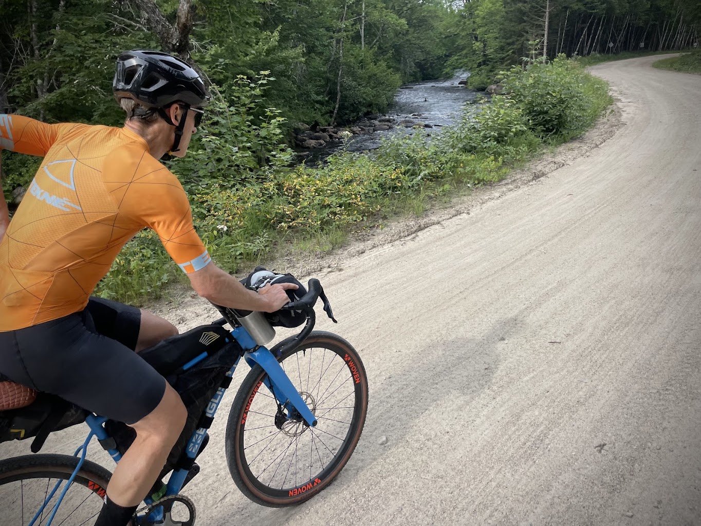
Iain was on 650B x 40mm tires, which were just enough for him; Iain is a very skilled off-road rider. He’s also very strong, so his 46×44 low gear was passable. This would not be an acceptable climbing gear for most riders.
We stayed at the Secteur de la Pimbina-Saint-Donat Cyclocamp site, which is situated right at the eastern gateway of the park near Saint-Donat. You register at the gate, roll in, set up where you like. The spot is up against a lake with cottages across the water, as you’re on the edge of the park. In contrast, the Diable Secteur’s spots are within the park entirely, and more pristine.
Learning: We didn’t realize there’s a cyclocamp zone at Pimbina!
Check out more details: Sépaq Bienvenue cyclistes! Program Page
Day-3
Day 3: Pimbina to Lac Cameron
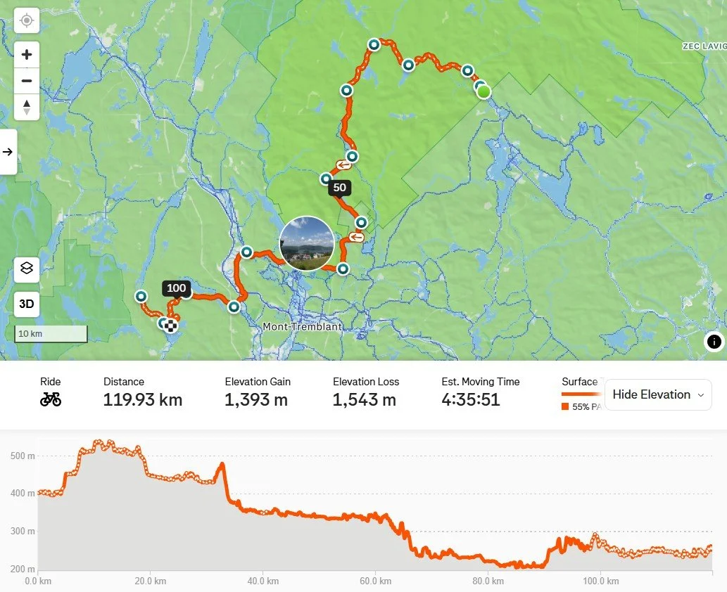
This leg really reinforced our understanding of how phenomenally good Parc Mont Tremblant is for riding. There are countless gems to uncover within the park, like the canoe put-in spot we paused at for a snack. We stayed on main roads, mostly dirt, but a multi-use trail network spans more than 50km. The main road we took to connect back through the Diable entrance - Boucle-des-Chutes-Croches - is totally appropriate for tires around the 40mm size, in keeping with the accessibility theme. And it’s both beautiful and fun!
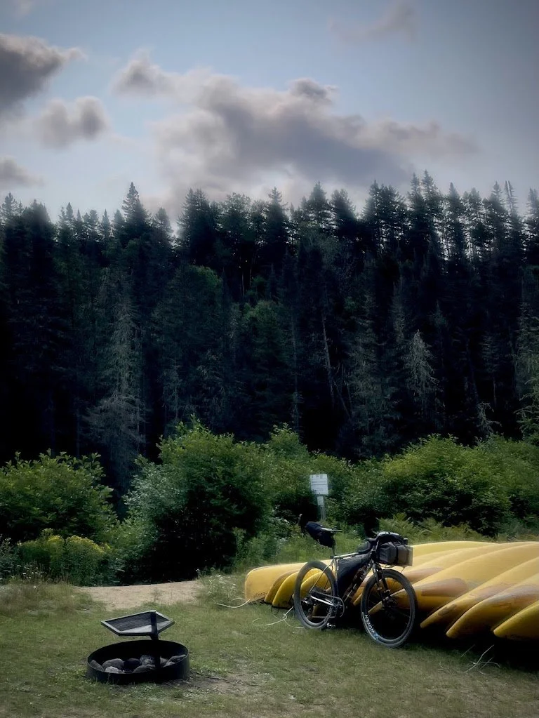
Canoe rental spot sort of in the middle of nowhere. We assumed you paddle downriver and turn it in. What a great way to try canoeing!
Learning: As we rolled toward the Diable information centre we were confused about the proximity of the cyclocamp zone; wasn’t it closer to the buildings?! Turns out they’ve established a new, additional cyclocamp area!!! How great is this; more room, more mainstreaming of cycling activities!
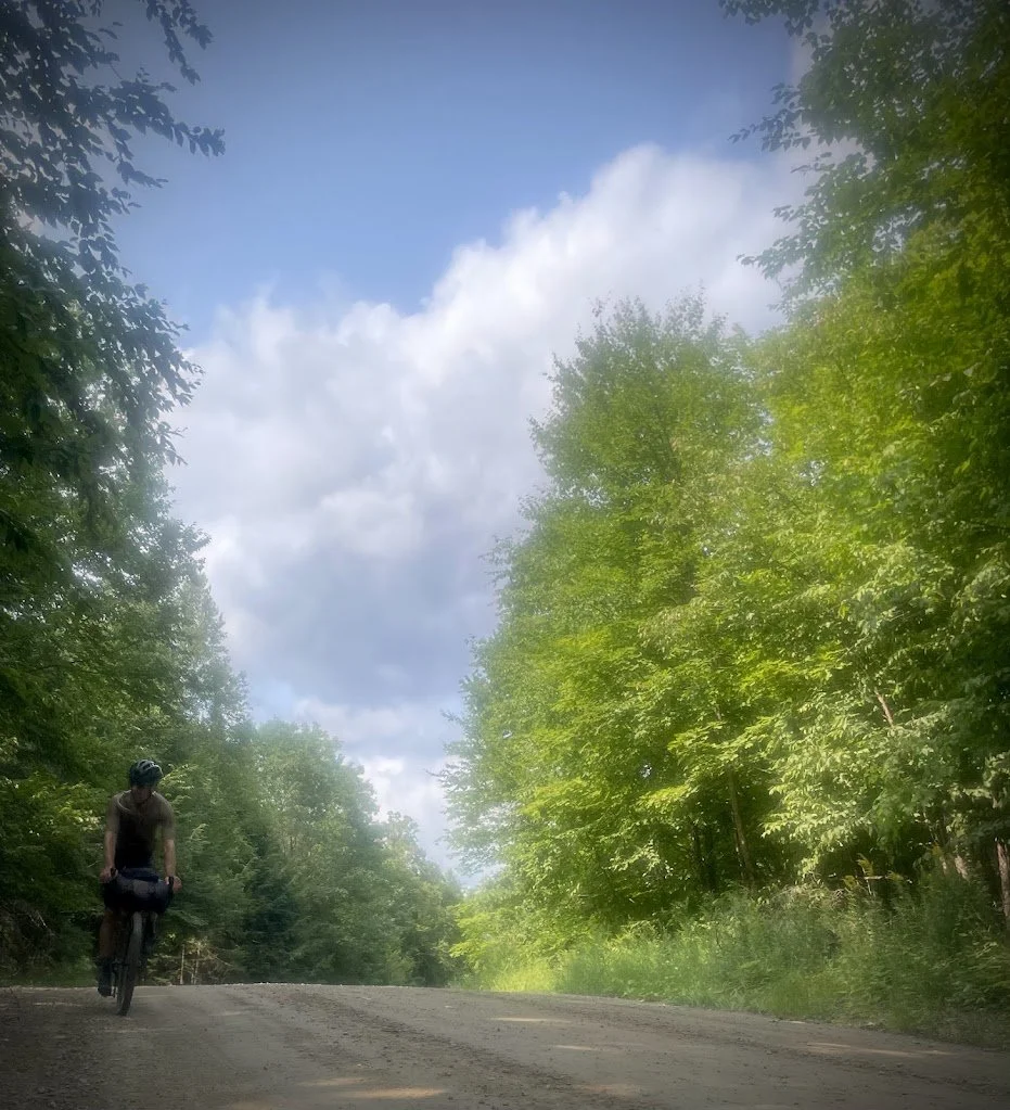
The end of a fantastic 3-day.
For our next trip, we’ll focus within Parc Mont Tremblant; it’s just that good! Our recon didn’t translate to establishing a new bikepacking route to recommend, it took us a big step closer to being able to do that.
If you have routes you’d like to share with other readers, and/or questions about this one, let’s have em! And if there are specific tech / gear questions and angles you’d like me to cover, let me know. Teaser: I have a couple relevant product tests starting up soon that will tie into this trip’s lessons well!